Introduction
Gray wolves are a species of large canid native to North America. They have been an integral part of the continent’s ecosystems for thousands of years. Recently, however, their populations have been in decline due to human activities such as habitat loss, hunting, and trapping. As a result, environmental scientists have been looking for ways to monitor and protect these animals.
The goal of this article is to explore how environmental scientists use technology to track gray wolves. It will examine the various methods used, including GPS tracking, radio collars, thermal imaging cameras, satellite imagery, and drone technology. The benefits and potential drawbacks of each method will be discussed, as well as recommendations for further research.
Utilizing GPS Technology to Track Gray Wolves’ Movements
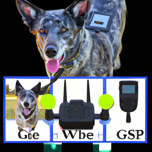
GPS (Global Positioning System) technology is one of the most commonly used methods for tracking gray wolves. GPS devices are small, lightweight units that can be attached to the wolf’s collar or harness. These devices use signals from satellites to determine the wolf’s location, which is then recorded by the device and transmitted to a computer or other device.
The primary benefit of using GPS technology to track wolves is that it allows scientists to get a detailed picture of the animal’s movements over time. This data can be used to build a better understanding of the animal’s behavior, ranging patterns, and habitat preferences. Additionally, GPS tracking can help scientists identify areas of critical importance for the species, allowing them to focus conservation efforts in those areas.
However, there are some potential drawbacks to GPS tracking. For example, the devices can be expensive, and they require regular maintenance and battery replacement. Additionally, GPS signals can be blocked or distorted in certain environments, making it difficult to accurately track the animal’s location. Finally, the data collected may not be accurate enough to draw meaningful conclusions about the animal’s behavior.
Exploring the Use of Radio Collars to Monitor Wolf Locations
Radio collars are another common tool used by environmental scientists to track gray wolves. These collars use radio waves to transmit the animal’s location to a receiver, which is typically located on the ground or in a vehicle. The receiver then records the data and transmits it to a computer or other device.
The primary benefit of using radio collars is that they are relatively inexpensive and easy to use. Additionally, they can provide real-time data about the animal’s location, allowing scientists to respond quickly to changes in the animal’s behavior. Finally, the data collected can be used to build a more complete picture of the animal’s habitat preferences and ranging patterns.
The potential drawbacks of radio collars include limited range and accuracy. Additionally, the data collected may not be precise enough to draw meaningful conclusions about the animal’s behavior. Finally, the collars can be uncomfortable for the animal and may interfere with its natural behaviors.

Examining Thermal Imaging Cameras to Map Wolf Habitats
Thermal imaging cameras are increasingly being used by environmental scientists to map wolf habitats. These cameras detect heat given off by the animal’s body and can be used to identify the animal’s exact location and movement patterns. The data collected can then be used to create detailed maps of the animal’s habitat.
The main benefit of using thermal imaging cameras is that they can provide a precise picture of the animal’s habitat. This data can be used to identify areas of critical importance for the species, allowing scientists to focus conservation efforts in those areas. Additionally, the cameras are relatively inexpensive and easy to use.
The potential drawbacks of thermal imaging cameras include limited range and accuracy. Additionally, the data collected may not be precise enough to draw meaningful conclusions about the animal’s behavior. Finally, the cameras can be uncomfortable for the animal and may interfere with its natural behaviors.

Applying Satellite Imagery to Assess Changes in Wolf Populations
Satellite imagery is another tool used by environmental scientists to assess changes in wolf populations. By analyzing satellite images of the area, scientists can identify changes in the environment that may impact the animals’ habitat. This data can then be used to monitor population trends and develop conservation strategies.
The primary benefit of using satellite imagery is that it provides a comprehensive view of the environment. This data can be used to identify areas of critical importance for the species, allowing scientists to focus their conservation efforts in those areas. Additionally, satellite imagery is relatively inexpensive and easy to access.
The potential drawbacks of satellite imagery include limited resolution and accuracy. Additionally, the data collected may not be precise enough to draw meaningful conclusions about the animal’s behavior. Finally, the images may not capture subtle changes in the environment that could have an impact on the species.

Investigating Drone Technology for Observing Wolf Behaviors
Drones are becoming an increasingly popular tool for observing wolf behaviors. These small, unmanned aircraft can be used to take aerial photographs and video of the animals in their natural habitat. This data can be used to identify areas of critical importance for the species, as well as to monitor population trends and assess changes in the environment.
The primary benefit of using drones for wolf observation is that they provide a unique perspective on the animal’s behavior. Additionally, drones are relatively inexpensive and easy to use. Finally, they can collect data in real-time, allowing scientists to respond quickly to changes in the animal’s behavior.
The potential drawbacks of drone technology include limited range and accuracy. Additionally, the data collected may not be precise enough to draw meaningful conclusions about the animal’s behavior. Finally, the drones may interfere with the animal’s natural behaviors or cause stress.
Conclusion
In conclusion, environmental scientists have a variety of tools at their disposal for tracking gray wolves. These tools include GPS technology, radio collars, thermal imaging cameras, satellite imagery, and drone technology. Each of these methods has its own benefits and potential drawbacks, but all of them can help scientists gain a better understanding of the animal’s behavior and habitat preferences. Additionally, these tools can be used to identify areas of critical importance for the species and develop effective conservation strategies.
Further research is needed to better understand the effectiveness of these technologies for monitoring gray wolves. Additionally, research should be conducted to identify new and improved methods for tracking the species. By doing so, environmental scientists can ensure that these animals are protected and their populations can thrive.
(Note: Is this article not meeting your expectations? Do you have knowledge or insights to share? Unlock new opportunities and expand your reach by joining our authors team. Click Registration to join us and share your expertise with our readers.)